
WEB / OPEN DATA / Available on the web
Stedsradar
From places to connections.
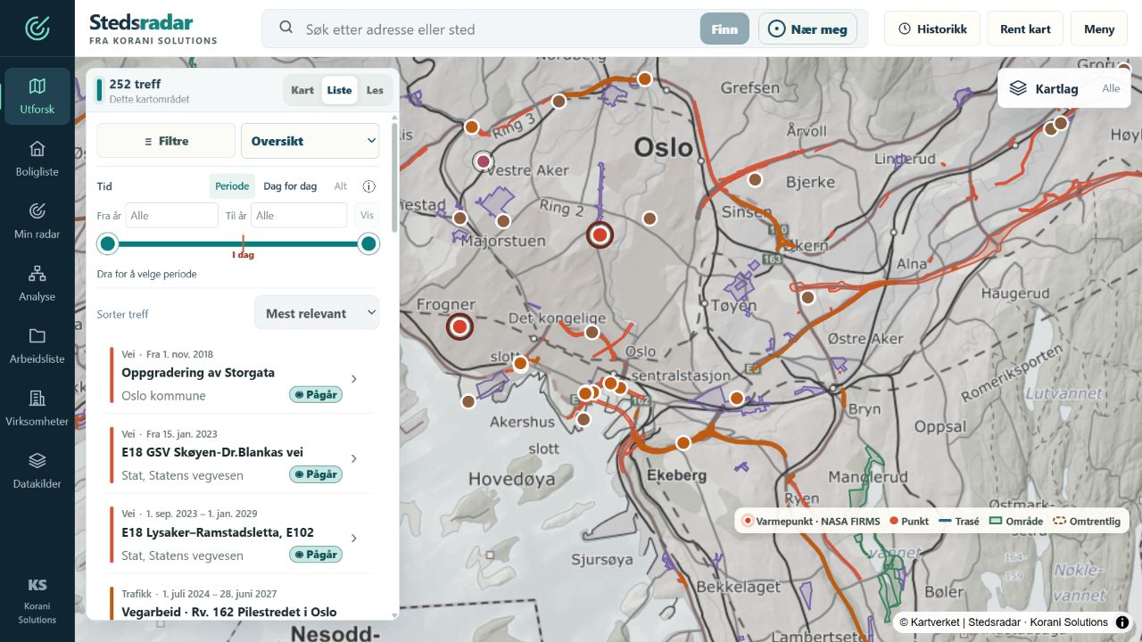
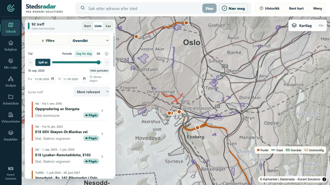
Explore public place-based data, investigate connections and keep findings you want to follow up. Day-by-day playback lets you follow available records over time in both the map and results list. Stedsradar also brings together analysis, property screening and personal worklists, with visible sources and no sign-in required.
 © Kartverket
What you can do.
- Explore traffic, planning notices, hazard alerts and other public data on the map
- Choose start and end years or play through available records day by day, directly in the map’s information panel
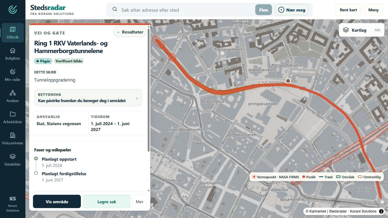
- Inspect each finding’s source, status, dates and geographic precision
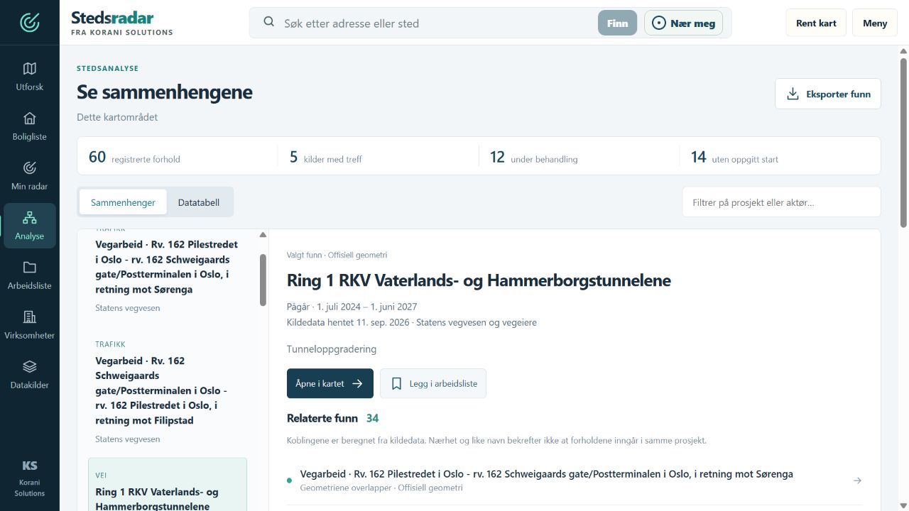
- Investigate calculated connections between findings in Analysis
- Follow saved areas and compare changes in My radar
- Organise findings with notes, status and deadlines, and look up registered businesses
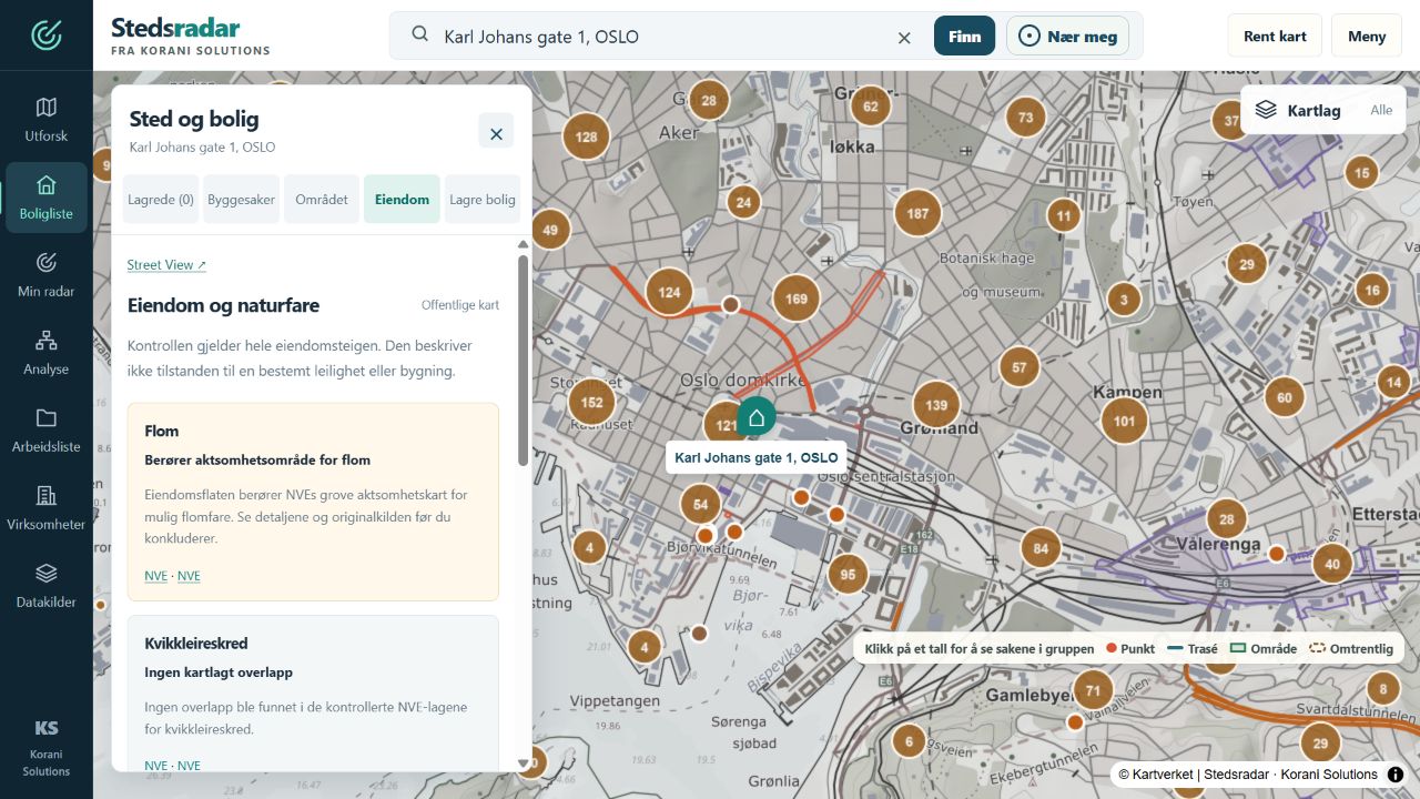
- Screen saved addresses against public property and hazard maps
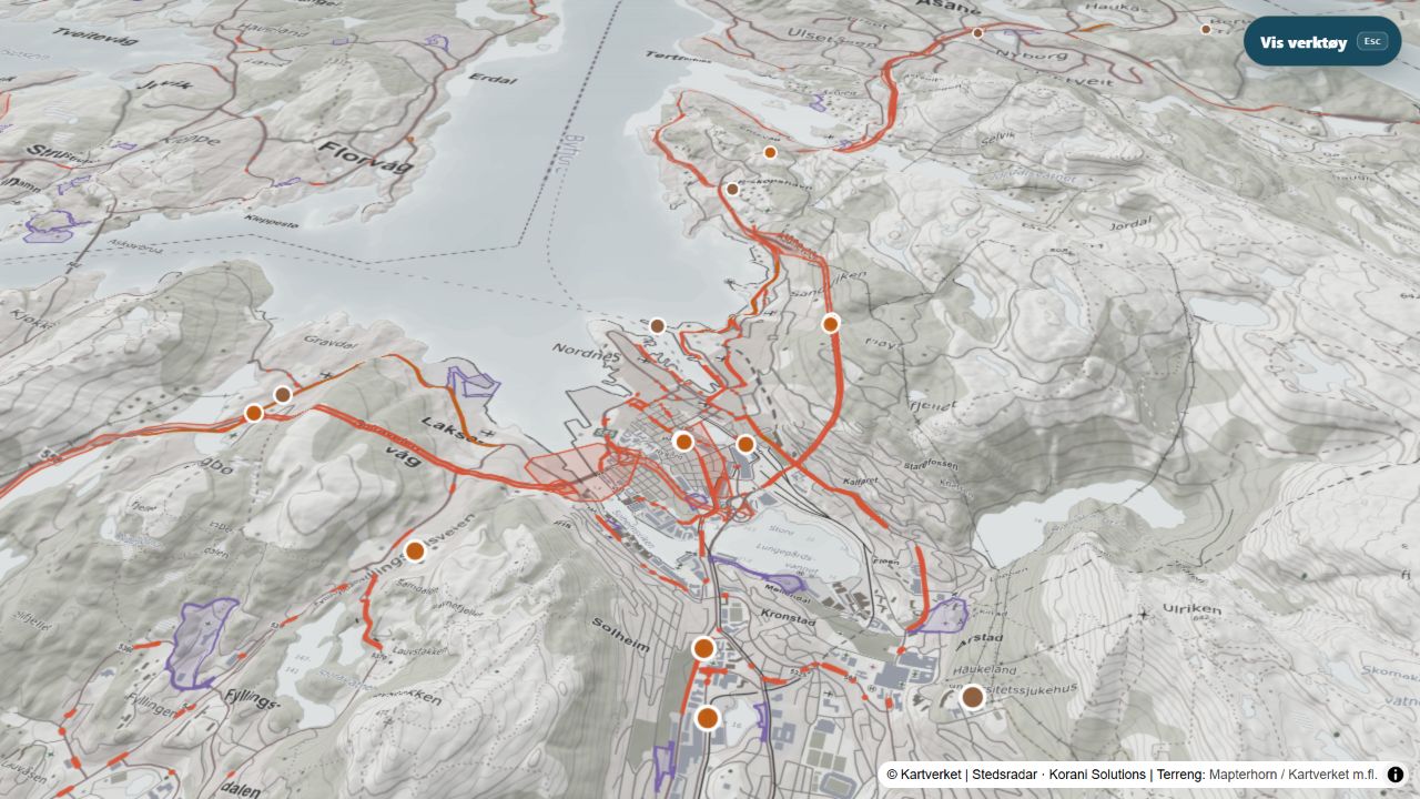
- Explore terrain in 3D and export supported findings as reports, CSV or calendar entries
From separate sources to a workspace you can investigate and use. Stedsradar shows how data integration, traceability and practical follow-up can work together. Personal lists stay in the browser. My radar compares checks while the app is in use; coverage varies by place and topic.
Municipal building applications currently cover Oslo. Housing list uses addresses and listing links you add yourself; property listings and sale prices are not fetched automatically. Property screening shows map information for further assessment.
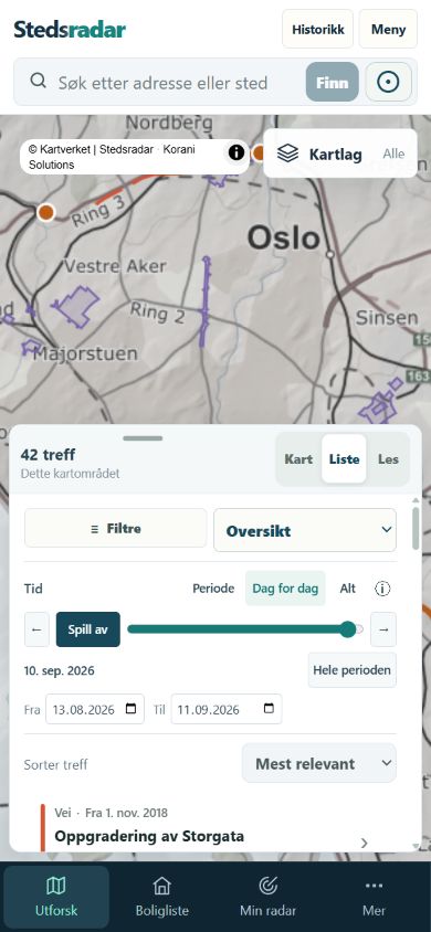
Choose a period, move to a date or play through available records day by day. The map and results list follow the same selection. Coverage varies by source: the timeline uses dates or validity periods, not a complete archive of past case statuses and text versions.
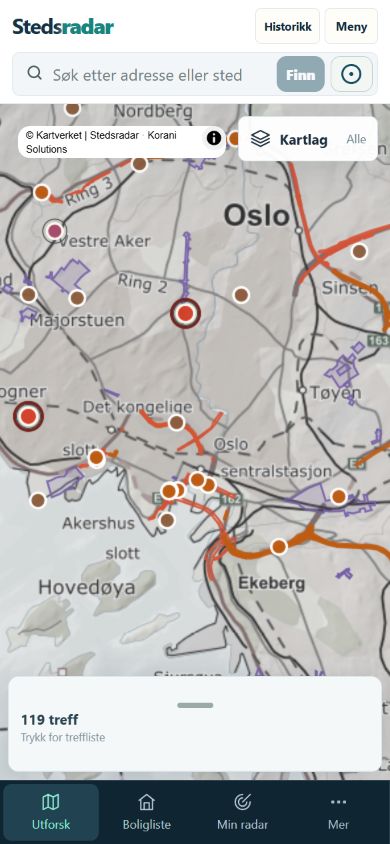
The same app. On mobile.
THE SAME MINDSET. YOUR CHALLENGE.